


LE BRUSQUET .Le tour des Blaches n

RobinMicheline
User GUIDE
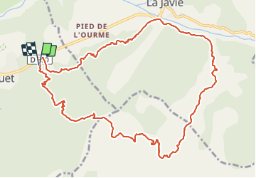

Length
13.4 km

Max alt
1193 m

Uphill gradient
515 m
Km-Effort
20 km

Min alt
803 m

Downhill gradient
514 m
Boucle
Yes
Creation date :
2021-09-25 07:34:14.295
Updated on :
2021-09-26 18:08:31.503
3h56
Difficulty : Difficult

FREE GPS app for hiking
 SityTrail
IGN / Geographical institutes
SityTrail Plus
The world is yours!
About
Trail Walking of 13.4 km to be discovered at Provence-Alpes-Côte d'Azur, Alpes-de-Haute-Provence, Le Brusquet. This trail is proposed by RobinMicheline.
Photos


Positioning
Country:
France
Region :
Provence-Alpes-Côte d'Azur
Department/Province :
Alpes-de-Haute-Provence
Municipality :
Le Brusquet
Location:
Unknown
Start:(Dec)
Start:(UTM)
285792 ; 4893485 (32T) N.
Comments